


Weather is a big deal in aviation. Whether you’re a real-world pilot or flying in Microsoft Flight Simulator, knowing how to read weather reports can mean the difference between a smooth flight and an unexpected disaster. That’s where METARs and TAFs come in.
If you’ve ever seen a string of random letters and numbers when checking the weather at an airport and thought, That looks like a secret code, you’re not wrong. But once you understand how to read them, these reports become invaluable tools for flight planning.
Let’s break them down and show you how to use them in the sim.
What is a Metar
A METAR (Meteorological Aerodrome Report) is a real-time weather report issued every hour (or more frequently if conditions change). It gives you current weather conditions at an airport, including:
- Wind speed and direction
- Visibility
- Cloud coverage
- Temperature and dew point
- Altimeter (pressure settings)
- Significant weather (rain, fog, thunderstorms, etc.)
Here’s an actual METAR:
EGLL 031450Z 22010KT 9999 FEW030 15/08 Q1022 Let’s decode it:
- EGLL – The ICAO code for London Heathrow Airport.
- 031450Z – The report was issued on the 3rd day of the month at 14:50 UTC.
- 22010KT – Wind is coming from 220° at 10 knots.
- 9999 – Visibility is 10 kilometers or more. (A METAR report might show “10SM” (10 statute miles) or “0400” (400 meters).)
- FEW030 – Few clouds at 3,000 feet.
- 15/08 – Temperature is 15°C, dew point is 8°C.
- Q1022 – Altimeter (pressure) is 1022 hPa (hectopascals).
Why METARs Matter in Microsoft Flight Simulator
If you’re using live weather, METARs tell you exactly what conditions to expect at your departure and arrival airports. Before you take off, check the METAR to see if you’ll be dealing with:
✅ Strong winds – Will you need to adjust for crosswinds on takeoff and landing?
✅ Low visibility – Is instrument flying (IFR) necessary?
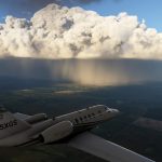
✅ Storms or turbulence – Do you need to climb above rough weather?
To check a METAR, visit https://metar-taf.com/ or use in-sim weather tools like MSFS’s ATIS reports.
What Is a TAF?
A TAF (Terminal Aerodrome Forecast) is like a weather crystal ball for pilots. It predicts weather conditions at an airport over the next 24-30 hours and is updated four times daily.
TAFs are essential when planning longer flights because they tell you what weather you’ll face at your destination.
Breaking Down a TAF
Here’s a real TAF:
LFPG 031100Z 0312/0418 22012KT 9999 BKN040
TEMPO 0315/0319 24015G25KT SHRA
What does it mean?
- LFPG – Paris Charles de Gaulle Airport
- 031100Z – Issued on the 3rd at 11:00 UTC.
- 0312/0418 – Valid from the 3rd at 12:00 UTC to the 4th at 18:00 UTC.
- 22012KT 9999 BKN040 – Base forecast: Winds 220° at 12 knots, visibility 10+ km, broken clouds at 4,000 feet.
- TEMPO 0315/0319 24015G25KT SHRA – Temporary conditions between 15:00 and 19:00 UTC: Winds shifting to 240° at 15 knots, gusting 25 knots, with showers.
Why TAFs Matter in Microsoft Flight Simulator
Imagine you’re flying from London to Paris in real time. The METAR at Heathrow shows great weather, but the TAF for Charles de Gaulle Airport (LFPG) predicts heavy rain and strong winds in two hours. That means:
✅ You should expect turbulence and crosswinds on arrival.
✅ You might need an alternate airport if conditions get worse.
✅ You can adjust your fuel load in case of delays.
How to Use METARs and TAFs in Flight Sim
Now that you understand METARs and TAFs, let’s use them effectively in Microsoft Flight Simulator.
1. Check Pre-Flight Weather
Before loading into the sim, check your departure and arrival airport weather at:
- https://metar-taf.com/ (Real-world data)
- Windy.com (Great for visualizing storms)
- In-game ATIS (Automatic Terminal Information Service)
2. Adjust Flight Plans Accordingly
- Strong winds? Pick the right runway for takeoff.
- Poor visibility? Be ready for an instrument approach (ILS or RNAV).
- Thunderstorms? Consider flying around rough weather, not through it.
3. Use Realistic ATC Services Like VATSIM
If you want a true-to-life experience, VATSIM controllers expect you to know the weather. When requesting clearance or approach, be ready to adjust for reported conditions. (see more on VATSIM in my previous post)
Final Thoughts
Reading METARs and TAFs might seem like decoding a secret language at first, but once you get the hang of it, they’re incredibly useful for realistic flight planning. Whether you’re dodging storms, picking the best runway, or deciding if an alternate airport is needed, these weather reports put you one step closer to flying like a real pilot—even in a simulator.
There are more abbreviations than we have covered here in this guide; a good source for all the abbreviations is found in this document. – https://www.weather.gov/media/wrh/mesowest/metar_decode_key.pdf
So, next time you load up Microsoft Flight Simulator, check the METAR and TAF before taking off. You’ll fly smarter, land safer, and—let’s be honest—look way cooler doing it.
Happy flying! ✈️